Portola Valley, California
Windy Hill
A windswept grass ridge in the Santa Cruz Mountains, where oak canyons give way to open hilltops and a view that reaches from the San Francisco Bay to the Pacific.
A preserve defined by its ridgeline.
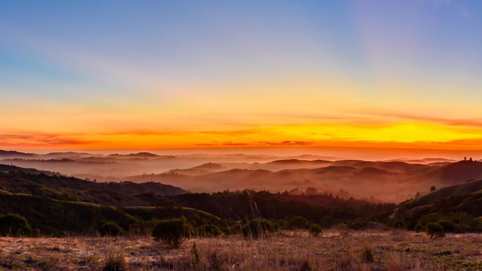
Windy Hill Open Space Preserve sits on the eastern slope of the Santa Cruz Mountains, directly above the town of Portola Valley in San Mateo County. It is one of the most recognizable landmarks on the San Francisco Peninsula: a pair of bald grass summits that catch the light and the wind, visible for miles across the valley below.
The preserve protects roughly 1,335 acres of grassland and woodland, climbing from the valley floor to a high, exposed ridge that crests near 1,900 feet. Its name is earned. Steady winds sweep up the western slope and over the top, keeping the hilltops open and treeless while the canyons below stay shaded and cool.
What follows is an educational field guide to the preserve: how its land is shaped, what grows there, the trails that cross it, and what to know before you visit.
From shaded canyon to open summit.
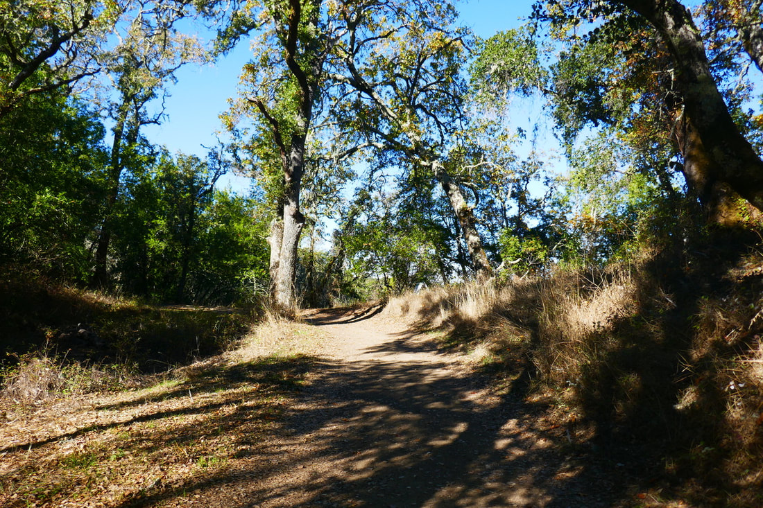
The preserve is built around a single dramatic gradient. At its lower edges, near Portola Valley, trails wind through cool, wooded canyons of coast live oak and California bay laurel, following seasonal creeks beneath a closed canopy.
As the land rises, the trees thin and the slope opens into broad grassland. The upper third of the preserve is almost entirely treeless: rolling, wind-combed grass that turns green in winter and gold by early summer. The transition is abrupt enough to feel like crossing into a different landscape.
The high point of the ridge sits around 1,905 feet, with the twin grassy knolls of Windy Hill itself standing just below the Skyline crest. The elevation difference between the lower trailheads and the summit is close to 1,300 feet, which is why every route to the top is a genuine climb.

- Valley floor
- Wooded canyons
- Grassland slope
- Summit ridge
Two coasts from one hilltop.
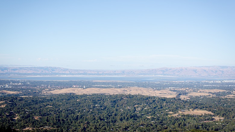
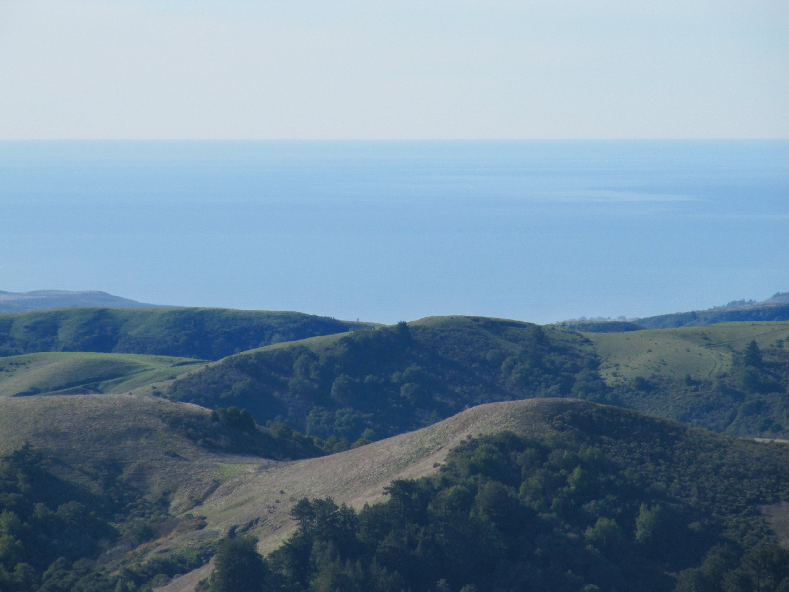
Few viewpoints on the Peninsula take in both sides of the range at once. The open summit of Windy Hill does. With nothing but grass between you and the horizon, the ridge offers a clean sweep in every direction, weather permitting.
Across the Bay
Down over Portola Valley and the Peninsula cities to San Francisco Bay, the East Bay hills, and on clear days the Diablo Range standing behind them.
Toward the Pacific
Over the forested spine of the Santa Cruz Mountains to the coastal hills and the Pacific Ocean beyond, where fog often pools in the valleys at dawn.
Seven ways up the hill.
The preserve's trails fall into two families: the open, sun-struck climbs of the grassland and the shaded routes through the canyon woodland. Most visitors combine one of each into a loop. Distances and elevation figures below are approximate.
- EasyShort, gentle grade
- ModerateSustained but even
- StrenuousLong, sustained climb
Spring Ridge Trail
StrenuousA wide, exposed fire road that climbs the grassy face directly to the ridge. Steady, popular, and fully open to the sun and wind.
- 2.6 mi (one way)
- ~1,300 ft
- Open grassland
Hamms Gulch Trail
StrenuousA shaded, single-track climb through oak and bay woodland along Hamms Gulch. The cooler, quieter counterpart to Spring Ridge.
- 2.7 mi (one way)
- ~1,250 ft
- Forested canyon
Razorback Ridge Trail
StrenuousA switchbacking forest climb that links the canyon trails to the upper ridge at a measured grade.
- 2.0 mi (one way)
- ~1,000 ft
- Forested switchbacks
Lost Trail
ModerateA gentle woodland traverse that ties Hamms Gulch and Razorback Ridge together for loop options.
- 1.5 mi
- ~350 ft
- Woodland connector
Anniversary Trail
EasyA short walk from the upper Skyline parking to a high viewpoint near the top, the quickest taste of the summit panorama.
- 0.5 mi
- ~150 ft
- Ridge viewpoint
Betsy Crowder Trail
EasyA lower meadow connector that traces the edge of the preserve, easy walking with open valley views.
- 1.3 mi
- ~250 ft
- Lower meadow
Eagle Trail
EasyA short connector near the Alpine Road frontage, linking the lower meadows to the canyon routes.
- 1.1 mi
- ~200 ft
- Lower meadow
A wind-shaped mosaic.
The same wind that named the hill also writes its ecology. It holds the summits in open grass while the sheltered canyons grow dense with oak and bay. The result is two habitats stacked on one slope, each supporting its own community of plants and wildlife.
Open grassland
Wind keeps the summits treeless. Native and naturalized grasses green up with winter rain and cure to gold by summer.
Oak & bay woodland
The canyons hold coast live oak and California bay laurel, shading creeks and a cooler understory.
Spring wildflowers
After the rains, the grassland slopes carry poppies, lupine, and other native bloom across the open face.
Native wildlife
The mosaic of grass and forest is habitat for deer, bobcat, coyote, raptors, and many resident and migrating birds.
What an open space preserve is.
An open space preserve is public land set aside to stay undeveloped. Rather than the built facilities of a typical park, a preserve protects the land itself, its habitat, watershed, and scenery, and opens it to quiet, low-impact recreation like hiking, riding, and watching wildlife.
Windy Hill is managed by the Midpeninsula Regional Open Space District, known as Midpen, a public agency that protects a connected greenbelt of preserves across the Santa Cruz Mountains and foothills. The District acquires and stewards these lands so they remain open to the public and intact for the long term.
The aim is balance: keeping the ridge accessible to people while conserving the grassland and woodland that make it worth protecting in the first place.
Planning a visit.
Trailheads & parking
Skyline (upper) trailhead
Roadside parking along the ridge, near the top of the preserve. The fastest access to the summit and the short Anniversary Trail viewpoint.
Portola Valley (lower) trailhead
Lower-elevation access to the meadow connectors and the canyon climbs. Start here for a full bottom-to-top ascent.
Good to know
- Fees
- None. Free to enter and park.
- Hours
- Open daily, dawn to dusk.
- Dogs
- Allowed on leash on designated trails. Check posted signs.
- Biking
- Permitted on designated trails and fire roads.
- Horseback riding
- Permitted on designated trails.
The ridge is open and often windy, with little shade up top. Bring layers and water, and expect conditions on the summit to be cooler and breezier than at the trailhead, even on warm days.
Responsible recreation
Leave the ridge as you found it.
Stay on established trails to protect the grassland from erosion, pack out everything you bring in, give wildlife room, and keep dogs leashed where allowed. The grass is fragile and the slopes are steep, so shortcutting switchbacks scars the hillside for years. A light footprint keeps this place open for everyone who comes after.